
Area residents hear Iowa DOT update on historic properties identified in study regarding Black Hawk Bridge project; Engineering report reveals further details
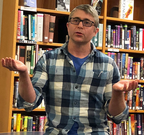
Black Hawk Bridge meeting ... Iowa Department of Transportation Cultural Resource Project Manager Brennan Dolan addressed a capacity crowd Wednesday, May 2 at the Meehan Memorial Lansing Public Library regarding the Black Hawk Bridge project proposed by the Iowa DOT. He spoke of historic properties identified in a DOT study associated with the bridge project, and also shared an engineer’s report regarding the project. Photo by Susan Cantine-Maxson.
by Susan Cantine-Maxson
Brennan Dolan, Iowa Department of Transportation (DOT) Cultural Resource Project Manager, met with interested area residents regarding further discussion pertaining to the Black Hawk Bridge project plan Wednesday, May 2 at the Meehan Memorial Lansing Public Library. A full house listened and asked numerous questions as Dolan and colleagues Shelby Ebel, Bryan Bradly and Emily Randall reviewed the findings of the Iowa DOT in regard to the proposed Black Hawk Bridge project.
This was the fourth meeting of DOT officials with the Lansing Historic Working Group. The two purposes of this meeting were to: 1) discuss historic resources identified as a result of the project area for the bridge and 2) discuss the options that the Iowa DOT, Wisconsin DOT and Federal Highway Administration (FHWA) have considered for rehabilitation and reuse of the current bridge.
Prior to the meeting, Dolan shared a formal letter and report from the engineering firm of Burns and McConnell from Kansas City, MO which had explored the possible rehabilitation and adaptation feasibility of keeping the current bridge. This report was sent to the Lansing History Working Group and may be reviewed at the Meehan Memorial Lansing Public Library on Main Street in Lansing.
Although the engineering group did propose three options, the letter states that the recommendation of the engineering firm is that none of the “rehab options be carried forward for further consideration due to design life, navigational clearance, approach issues, time length of bridge closure and the inability to meet the purpose and need of the project.”
The report further explains each of these factors in more detail. In addition, the engineering report states that the estimated closure time for a rehabilitation or adaptation of the current bridge would be approximately two years. In consideration of a new bridge, the engineers thought that a required closure would take eight to 12 weeks because the old bridge could be used while the new bridge is being built.
Figuring only the impact of additional miles needed to be driven, the cost to the public in driving expenses was estimated in the report to be $47.9 million. This is not figuring in the cost of lost business, plus the inconvenience to towns and people on both sides of the river for a 24-month closure.
The estimated cost of a rehabilitation/adaptation of adding a second roadbed and third truss to the existing bridge (option 1), which is really the only viable engineering option, would be approximately $53 million, according to the report. The other options explored included moving one of the sides of the bridge (the truss) and adding another lane for traffic or leaving the trusses where they are and adding a cantilevered section of roadbed next to the current bridge.
Both of these latter options were eliminated as “impractical and non-viable” in the report. Strengthening the current bridge was also explored, but it would involve so much replacement of materials and adaptation that it is also labeled in the report as not being a viable option.
RECOMMENDATIONS FROM THE ENGINEERING TEAM
The engineering report concludes, “We recommend that a rehabilitation and widening option not be considered. A new bridge designed to current standards would be much more efficient use of resources and time. A much longer design life could be obtained with much less disruption to vehicular and navigational traffic. Navigation clearance, bridge width and approach alignment issues are better addressed with a new structure that meets the purpose and need of the project.” The final decision has not been made but the Iowa DOT, Wisconsin DOT and FHWA are taking this report under advisement.
Dolan emphasized that many stakeholders have input into this decision process. Representatives from the local level, the Wisconsin DOT, the Iowa DOT, the historic preservation offices at the federal, state and local level, as well as the Historic Bridge Foundation, the U.S .Army Corps of Engineers, the U.S. Fish and Wildlife Service and the U.S. Coast Guard are all reviewing the project alternatives. No final decision has been made.
Individuals who would like to comment about this issue should contact the Iowa DOT or Brennan Dolan at 515-239-1795 or brennan.dolan@iowadot.us. If the bridge project is included in the next five-year plan for the DOT, a decision about probable placement would be made toward the end of 2019 and early 2020. Contracts would not be awarded until 2024.
CURRENT BRIDGE DEFICIENCIES
The current Black Hawk Bridge, which is a connection between Wisconsin and Iowa via IA 9 and WI 82 over the Mississippi River, is 88 years old. The study being conducted by the Iowa DOT is to determine the best solution to “provide infrastructure that meets current operational standards, provide appropriate clearances for river navigation and consider impacts to environmental and community resources.”
The 2017 Bridge Safety Report rates the deck (roadbed) as Satisfactory (6), the substructure (below the deck) as Fair (5) and the superstructure (upper structure) as Poor (4).
The study includes a purpose and need for action, as follows: “The purpose of the proposed action is to improve the river crossing across the Mississippi River at Lansing, Iowa. The need for the proposed action is based on a combination of factors and can be summarized as roadway deficiencies, system linkage and modal interrelationships. To be considered a viable solution, a rehabilitation concept would need to meet the Purpose and Need of the project.” As earlier concluded within the report, none of the rehabilitation options are able to meet the study’s purpose and need of the project.
ROADWAY DEFICIENCIES, SYSTEM LINKAGE AND MODAL RELATIONSHIPS
The current DOT report concentrates on examining the roadway deficiencies, the system linkage and the modal relationships. One of the main roadway deficiencies is the width of the roadway and the lack of shoulders. The total roadway is 21 feet wide. The current recommendation for a bridge road width is 44 feet. In addition, the metal road bed requires continual maintenance to replace broken welds.
The current bridge, when it was rehabilitated in 1952, was designed for a truck weighing 40,000 lbs. and is posted with that limit. Yet the current standard truck weight for the design of a bridge is 72,000 lbs.
The T-intersection approach from IA 9 at the west bridge approach does not provide adequate turning radius for larger trucks. There is limited sight distance because of the high grades on the bridge approaches. In addition, the vertical clearance on the bridge is 14’11” and the horizontal clearance (for vehicular traffic) is 21’. The current standard for a two-lane roadway is 17’6” for vertical clearance and 32’ for horizontal clearance.
The bridge system links several important regions because of the flow of traffic from Iowa to Wisconsin and vice versa. Lansing maintains businesses that draw from both sides of the river as well as its focus on tourism, historic and scenic properties and wildlife and recreation. Entities such as the Great River Road Scenic Byway, the Upper Mississippi River National Wildlife and Fish Refuge, Mount Hosmer Park and the Driftless Area Visitor and Education Center are draws to the area.
The bridge provides access to health care and educational opportunities as well as employment in the area. Trucks transporting agricultural products, fuels and construction materials use the crossing. The average daily traffic at the bridge in 2017 was 2,010 vehicles with 89% of those being passenger vehicles and 11% trucks. Compared to statewide averages, these numbers are not high, but all of these factors show a strong need for a continued link at this crossing.
The modal relationships relate to the river navigation. The piers (supporting columns) of the current bridge piers are an issue. This section of the river is particularly narrow. In addition, it is one of the sharpest turns in the river. Only one direction of barge traffic is allowed at a time. Maneuvering the barges downstream is more difficult so barges headed upstream must yield. Barges may run aground as they turn downstream, which often causes the barges to break apart. According to the study, 20 such collisions have been recorded.
Any rehabilitation option considered would require most of the piers to be replaced and repositioned to provide greater width between the river channel piers. In addition, the eastern piers do not rest on bedrock but on piles of timber. New piers would need to be more stable. Other modes of transportation are also limited since there is no access to pedestrian or bike traffic because of the limited width of the current roadbed.
HISTORIC PROPERTIES IDENTIFIED
At the May 2 meeting, Dolan identified historic properties which may be impacted depending on the placement of a replacement bridge. He listed four criteria which are considered for a property to be placed on the state and national historic register. Those criteria are: 1) significant historic event; 2) significant historic person; 3) unique architectural styling/work of a master; or 4) archaeological research potential. To be considered for the National Register, at least one of these criteria must be met.
The discussion covered historic resources in addition to the Lansing Main Street Historic District, which was placed on the National Register of Historic Places in 2014. Another building currently on the National Register was the Fisheries Building (currently the VFW building). This structure was listed in the National Register in 1991 because of its significant historical connection to conservation, the listing for the fisheries building identifies a period of significance from 1915-1942.
One property determined eligible for listing to the National Register as a result of the Iowa DOT survey work was the Jeremiah and Mary Turner house located at 291 North Front Street. Amongst a host of historical connections, Turner started the Turner Button Factory, was a noted river boat captain and a Civil War veteran. The Turner House was built around 1870. In addition, the original Turner stable is still intact, which would then qualify the property as a district since there are at least two properties. The period of significance was 1879-1928.
A second property which has been determined eligible for the National Register is the Spinner-Brennan historic district, two houses next to each at 401 North Front street. These houses, built in the 1870s, represent unique architecture from that time period.
Iowa DOT, Wisconsin DOT and FHWA officials are charged with working to avoid these historic/cultural resources along with natural resources know to the area like the refuge, critical mussel habitat, bald eagle nests, etc. The team members from the Iowa DOT discussed their roles in working to find a best fit for the project, while balancing the needs of the community.
Additional meetings are being planned to further discuss numerous aspects of the proposed Black Hawk Bridge project. Dates for those meetings have not yet been scheduled.