
USGS, National Weather Service working to predict flooding locally
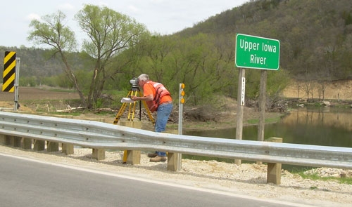
USGS Hydrologic Technician Scott Strader performs a routine survey to validate water-surface elevations at the Upper Iowa River near Dorchester. Submitted photo.
by Lissa Blake
It’s hard to prevent a natural disaster.
But, when it comes to flooding, U.S. Geological Survey (USGS) hydrologists do everything they can to predict one.
During a recent presentation in Decorah, USGS Hydrologist Jon Nania of Iowa City and National Weather Service (NWS) Service Hydrologist Mike Welvaert of La Crosse, WI discussed how a number of river gauges located in northeast Iowa can help predict potential flooding disasters.
Nania said basic hydrologic collection is a major part of the USGS Iowa Water Science Center program, based in Iowa City with field offices in Council Bluffs and Fort Dodge. Regionally, USGS hydrologists, hydrologic technicians and other science professionals collect data and conduct studies to help federal, state and local cooperating agencies solve practical water problems.
Stream gauges throughout northeast Iowa provide stage and flow information online via satellite link in real time.
Upper Iowa River gauges are located at Lime Springs, Kendallville, Bluffton, Decorah and Dorchester. The USGS also monitors gauges on Dry Run Creek in Decorah, Waterloo Creek near Dorchester, and the Yellow River near Ion. The Turkey River is monitored with gauges in Spillville, Eldorado, Elkader and Garber.
“We have long periods of record, going back quite a few years,” said Nania. He explained the USGS team travels from Iowa City to personally visit the gauges at least every six weeks, and more often during flood events.
“Most of our gauges are run by solar power,” he said. Data collected includes stream-flow data; water-quality data from streams, wells and lakes; groundwater levels, precipitation quantity and quality and biological characteristics of streams.
Nania said the data helps USGS study a number of water issues, including National Water Quality assessment of agriculture chemicals: sources, transport and fate; water-quality and water-quantity assessments; environmental contamination site investigations; effects of toxic substances in natural water; effects of rural and urban non-point pollution; surface-water/groundwater interactions; sediment transport and chemistry; effects of climate change; effects of acid precipitation; wetland functions and hydrology; aquifer and streamflow characterization; streamflow and water-quality modeling; effects of droughts and floods and Brownfield site technical assistance (The term “Brownfield site" means real property, the expansion, redevelopment, or reuse of which may be complicated by the presence or potential presence of a hazardous substance, pollutant, or contaminant).
All equipment used by the USGS is tested and approved at its center in Mississippi. “Accuracy is to within 100th of a foot,” said Nania.
Nania explained the measurements taken on the rivers and creeks are referenced to sea level and use “strict published protocols to verify elevation.” In addition, he said there is routine maintenance of the gauges and quality assurance measures, to make sure the data collected is as accurate as possible.
LOCAL WATERSHEDS
Welvaert said due to the karst topography of northeast Iowa, river forecasting can really be a challenge. “You’ve got sinkholes, water running underground and springs popping up. It does make it harder to make river forecasts,” he said.
He said when trying to forecast places downriver, hydrologists tend to overestimate the threat, which can be abated by water finding alternate pathways underground. He said the National Weather Service relies greatly on the gauges and the work being done by the USGS. “They collect high-quality data. They are meticulous about how they collect it and how they publish it,” he said.
Welvaert said with regard to using the data to try to figure out the peak danger zones for flood events, “It’s not always perfect. There is a lot that goes into it, and we’re all still working on it.”
He added, when the public views data related to water flow, they should equate a cubic foot of water being equal to the size of a basketball. “These are not slow, lazy rivers,” he said, adding that’s what makes them ideal for recreational tourism.
Anyone interested in viewing the data associated with the river gauges in northeast Iowa can visit ia.water.usgs.gov or noaa.gov.