

Heavy rains early Sunday morning followed by more rains Monday morning of last week prompt flood warnings, push Upper Iowa River to near Moderate Flood stage
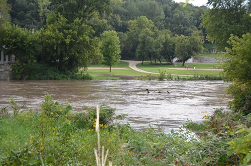
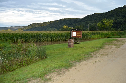
Heavy rainfall sends Upper Iowa River out of its banks early last week to its highest crest in six years ... Flowing as high as it’s been in more than six years, the raising of the Upper Iowa River the early part of last week, Sunday, August 17 through Monday, August 18, resulted in not only high, fast-flowing water but also took with it some river bank debris, such as the “Log Mess Monster” sighting in the center of the photo above. That photo also shows the overflowing river spreading into the lawn and campground areas at Upper Iowa Resort and Rental south of Dorchester, resulting in that campground facility urging campers near the river’s edge to be moved and closing several campsites through this past weekend in an effort to dry them out. The overflow of the Upper Iowa River into adjacent cropland is evident in the second photo taken at Kumpf’s Landing along Iowa River Drive near the English Bench area southeast of Dorchester, with the water creeping into the river access area at Wild Landing pictured in the third photo at the intersection of Iowa River Drive and Lycurgus Road and also breaching fence lines near its intersection with Morgan Bridge Road southwest of New Albin, as seen in the lower photo. Photos by Brianne Grimstad.

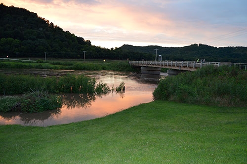
Rainfall totals nearing double digits from the very early morning hours of Sunday, August 17 through early evening Monday, August 18 helped push the Upper Iowa River out of its banks a bit to the brink of Moderate Flood Stage in northern Allamakee County, as evident in the photos accompanying this article below taken Monday evening, August 18. The first round of storms that moved their way through the tri-state area as Saturday, August 16 transitioned into Sunday, August 17 resulted in an initial Flood Advisory being issued by the National Weather Service for the northern portion of Allamakee County from 11 p.m. Saturday to 2 a.m. Sunday, with local reports ranging from four to six inches of rain falling in that timeframe within that portion of the county and west through the Upper Iowa River corridor.
After a relatively dry day locally Sunday, August 17, heavy rains returned Monday morning, August 18, dumping another two to three inches in several hours over that same area saturated over the weekend and resulting in a Flash Flood Warning being issued at approximately 7:20 a.m. Monday and being in place until 11 a.m. for the northwestern corner of Allamakee County as part of a warning that also covered nearly all of Winneshiek County and further west. At the expiration of the Flash Flood Warning, a Flood Warning was issued for that same area, in addition to a Flood Warning being issued specifically for the Upper Iowa River, with both of those warnings being extended several times as the impact of the rains played out, until being allowed to expire early Tuesday morning, August 19 and early Wednesday morning, August 20, respectively.
Allamakee County Emergency Management Coordinator Corey Snitker says the impact of the heavy rainfall has been minimal and similar to other high rain events from the past. Neighboring counties in northern Iowa, such as Winneshiek and Howard, and some in southeast Minnesota, experienced road closures and some municipalities called on residents to limit water usage as their sewer and water systems struggled to keep up with the heavy rainfalls.
“It may have helped that our rain was over a couple of days, with the Sheriff’s Office having about seven inches Friday night into Monday with over four inches of that coming Sunday morning and another three by Monday,” Snitker shared. “I know areas got more and others not as much, as this storm system really formed a linear pattern and kept moving very slowly over the same areas.”
To read the full article, pick up the Wednesday, August 27, 2025 print edition of The Standard or subscribe to our e-edition or print edition by clicking here.
